Property Record
12220 Apache Ave, Savannah, GA 31419


Save to a Folder
{{folder.Name}}
{{folder.ListingIds.length}} Properties
{{folder.ListingIds.length}} Property
Create a New Folder
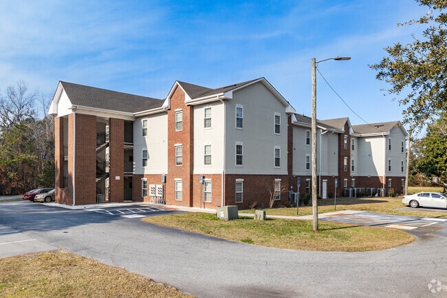
Property Detail
12220 Apache Ave
2086203047
RECOMBINATION OF ARMSTRONG DORMI TORIES PRB 32P 15 5.70AC
Apartment
Chatham
PRM15
Georgia
C and X Area of minimal flood hazard, usually depicted on FIRMs as above the 500-year flood level.
5.70 AC
2025
Windsor Forest
2025
Savannah
004212
Savannah, GA
35,592 SF
NEARBY LISTINGS FOR SALE OR LEASE
-
-
View all Savannah listings for sale on LoopNet.com
DEMOGRAPHICS near 12220 Apache Ave
1 mile
3 mile
5 mile
2025 Total Population
5,356
35,106
76,279
2030 Population
5,567
36,185
79,240
Pop Growth 2025-2030
+ 3.94%
+ 3.07%
+ 3.88%
Average Age
38
39
39
2025 Total Households
2,203
14,584
30,982
HH Growth 2025-2030
+ 4.49%
+ 3.19%
+ 3.85%
Median Household Inc
$50,750
$65,647
$65,561
Avg Household Size
2.00
2.20
2.30
2025 Avg HH Vehicles
1.00
2.00
2.00
Median Home Value
$234,916
$263,663
$281,414
Median Year Built
1983
1982
1985
Nearby Places
Map Layers
Map Styles
 Street
 Aerial
Layers
 Traffic
 Biking
Places
Listings with unknown addresses are not visible on the map
- Restaurants
- Banks
- Shops
- Fitness
- Groceries
PUBLIC TRANSPORTATION
AIRPORT
Savannah/Hilton Head International
Drive
Walk
Distance
Savannah/Hilton Head International
30 min
15.9 mi
Freight Ports
Georgia Ports - Savannah
Drive
Walk
Distance
Georgia Ports - Savannah
26 min
14.8 mi
Nearby Properties
Address
Land Use
TOTAL SIZE
Lot Size
Zoning
Address
Land Use
TOTAL SIZE
Lot Size
Zoning
19,432 SF
214.77 AC
R3
Address
Land Use
TOTAL SIZE
Lot Size
Zoning
942,210 SF
50.60 AC
Address
Land Use
TOTAL SIZE
Lot Size
Zoning
565,144 SF
19.74 AC
I-P
Address
Land Use
TOTAL SIZE
Lot Size
Zoning
18,138 SF
12.80 AC
RM25
Address
Land Use
TOTAL SIZE
Lot Size
Zoning
16,896 SF
11.32 AC
IP
Address
Land Use
TOTAL SIZE
Lot Size
Zoning
7,344 SF
13.09 AC
RM25
Address
Land Use
TOTAL SIZE
Lot Size
Zoning
8,064 SF
14.70 AC
RM25
Address
Land Use
TOTAL SIZE
Lot Size
Zoning
13,920 SF
14.50 AC
RM25
Address
Land Use
TOTAL SIZE
Lot Size
Zoning
16,138 SF
18.33 AC
PUDC
Address
Land Use
TOTAL SIZE
Lot Size
Zoning
27,408 SF
12.97 AC
PUDC
Address
Land Use
TOTAL SIZE
Lot Size
Zoning
2,033 SF
45.50 AC
R1
Address
Land Use
TOTAL SIZE
Lot Size
Zoning
17.78 AC
R1
Address
Land Use
TOTAL SIZE
Lot Size
Zoning
6,812 SF
9.48 AC
RM25
Address
Land Use
TOTAL SIZE
Lot Size
Zoning
6,296 SF
15.09 AC
PUDM15
Address
Land Use
TOTAL SIZE
Lot Size
Zoning
7,256 SF
8.73 AC
RM25
Address
Land Use
TOTAL SIZE
Lot Size
Zoning
10,200 SF
12.79 AC
RM25
Address
Land Use
TOTAL SIZE
Lot Size
Zoning
10,965 SF
17.34 AC
PUDM25
Address
Land Use
TOTAL SIZE
Lot Size
Zoning
13,824 SF
9.50 AC
R3
Address
Land Use
TOTAL SIZE
Lot Size
Zoning
13,152 SF
11.22 AC
RM25
Address
Land Use
TOTAL SIZE
Lot Size
Zoning
25,864 SF
8.04 AC
PBC
Address
Land Use
TOTAL SIZE
Lot Size
Zoning
38,268 SF
7.65 AC
RM25
Address
Land Use
TOTAL SIZE
Lot Size
Zoning
28.95 AC
M
Address
Land Use
TOTAL SIZE
Lot Size
Zoning
71,502 SF
10.60 AC
PUDIS
Address
Land Use
TOTAL SIZE
Lot Size
Zoning
124,110 SF
17.38 AC
PUDB
Address
Land Use
TOTAL SIZE
Lot Size
Zoning
25 AC
R6
Address
Land Use
TOTAL SIZE
Lot Size
Zoning
18,800 SF
8.71 AC
PUDC
Address
Land Use
TOTAL SIZE
Lot Size
Zoning
4,576 SF
20 AC
PUDM12
Address
Land Use
TOTAL SIZE
Lot Size
Zoning
75,884 SF
3 AC
R3
Address
Land Use
TOTAL SIZE
Lot Size
Zoning
3,975 SF
11.66 AC
BC
Address
Land Use
TOTAL SIZE
Lot Size
Zoning
6,200 SF
11.85 AC
R6
The World's #1 Commercial Real Estate Marketplace
Connect with us
© 2026 CoStar Group
The information above has been obtained from sources believed reliable. While we do not doubt its accuracy we have not verified it and make no guarantee, warranty or representation about it. It is your responsibility to independently confirm its accuracy and completeness. Any projections, opinions, assumptions, or estimates used are for example only and do not represent the current or future performance of the property. The value of this transaction to you depends on tax and other factors which should be evaluated by your tax, financial, and legal advisors. You and your advisors should conduct a careful, independent investigation of the property to determine to your satisfaction the suitability of the property for your needs.